
Along the Beach
We got up and hit the trail around 9:20, still stiff from the previous day's descent.
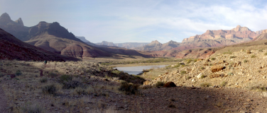
The mile+ down Tanner Beach went quickly. There are several false trails, and you need
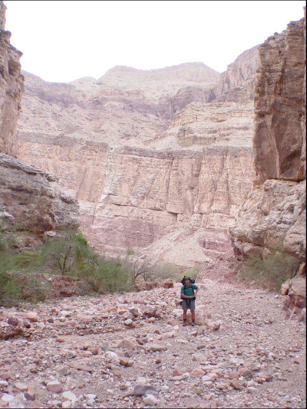
to keep off the dunes behind the beach. We reached Cardenas Creek and climbed the butte
that provides a spectacular view over Unkar Delta around 10:40. As impressive as this cliff was, it
was but the first part of our climb.
South and Ever Upward
The description of the Escalante Route describes the next section as:
"From Here, there is but one way to go: south and ever upward."
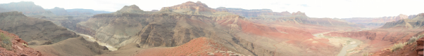
And up it goes. At 12:00 we stopped for lunch where the trail crosses the unnamed drainage and turns
back north. The trail is easy to follow, but it is impossible to see the trail on the west side of
the drainage from the east side. The route description lists climbing up to Buchart's Notch as an option,
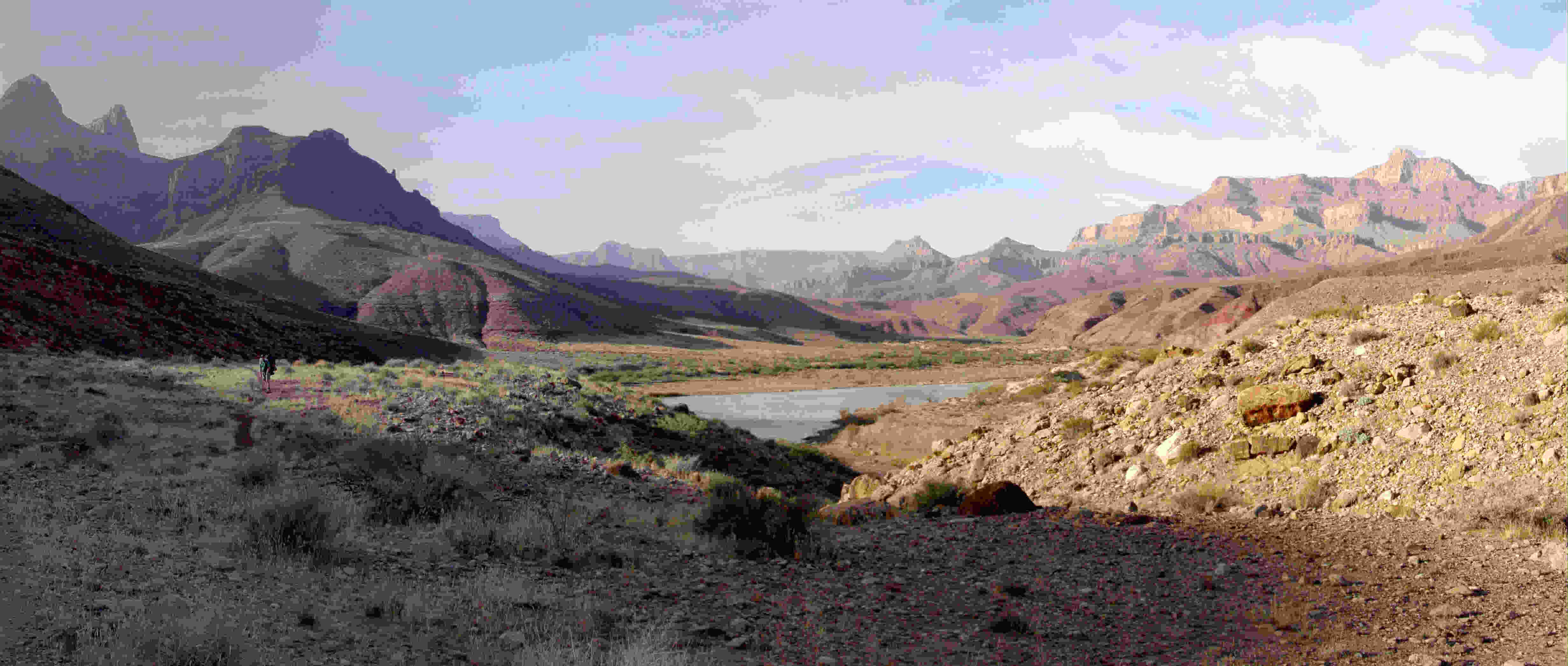
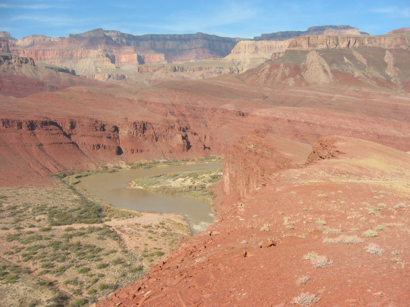
but we chose to follow the contour around the point. When you reach the top of the ridge, you get a view
even more impressive than the last cliff. (which now looks insignificant in the distance)
We continued on down the trail, reaching Escalnate Canyon around 3:00.

Escalante Canyon to 75 Mile Canyon
As there was still plenty of the day left, we pressed on toward 75 Mile Canyon, winding right along
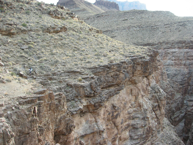
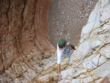
the edge of 75 Mile canyon. We reached the head of the canyon about 4:00 where we scrambled down one
steep face. Very shortly thereafter we arrived at the 12ft pouroff where we lowered the packs. (I climbed down first
so I could help from below as Mike lowered the packs). It was an easy climb with a small ledge about halfway down
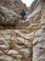
(what I'm standing on in the picture), but I would not want to do it with a pack on. The second image below shows the view
up from the bottom as Mike was preparing to come down. We reached the mouth of the canyon around 4:30, camping just to the
as we came down. The trail continued to the left right across the creekbed from our camp.
 Prev
Intro
Next
Prev
Intro
Next